

In case you haven’t noticed, it is a pivotal election year. Whether we like it or not, this is our democracy in progress. While the nation is fixated on the national race I’m reminded of the common axiom “all politics is local.” Local concerns motivate most voters – is my city safe, can I afford gas for my car, etc? Even at the national level, we elect representatives who are supposed to advocate for our local interests. And how do we assign local interests geographically? By establishing an intricate patchwork of overlapping administrative boundaries like school districts and voting districts. Today we look at a small snapshot of our valley’s jumble of jurisdictional boundaries.
This intricate patchwork reflects the inherent complexity of our democracy itself. Democracies distribute power across various levels – national, regional, and local. A single overarching governing body can’t effectively address the diverse needs of a complex population like ours. Overlapping jurisdictions, like states and counties with shared responsibilities for education or infrastructure, create a web of checks and balances. This complexity can be frustrating, sometimes leading to bureaucratic hurdles and finger-pointing.
But, paradoxically, this very complexity is also a strength. It ensures that decisions consider the varied voices within a democracy, hopefully fostering a more responsive form of government. Local communities have a say in matters that directly impact them, while the national government provides a framework for national unity and ensures a baseline standard for services. This multi-layered approach allows for experimentation and adaptation at the local level. In essence, overlapping boundaries are a testament to the messy but ultimately resilient nature of democracy, constantly striving to balance efficiency with representation. It’s a noble experiment if not a frustrating one.
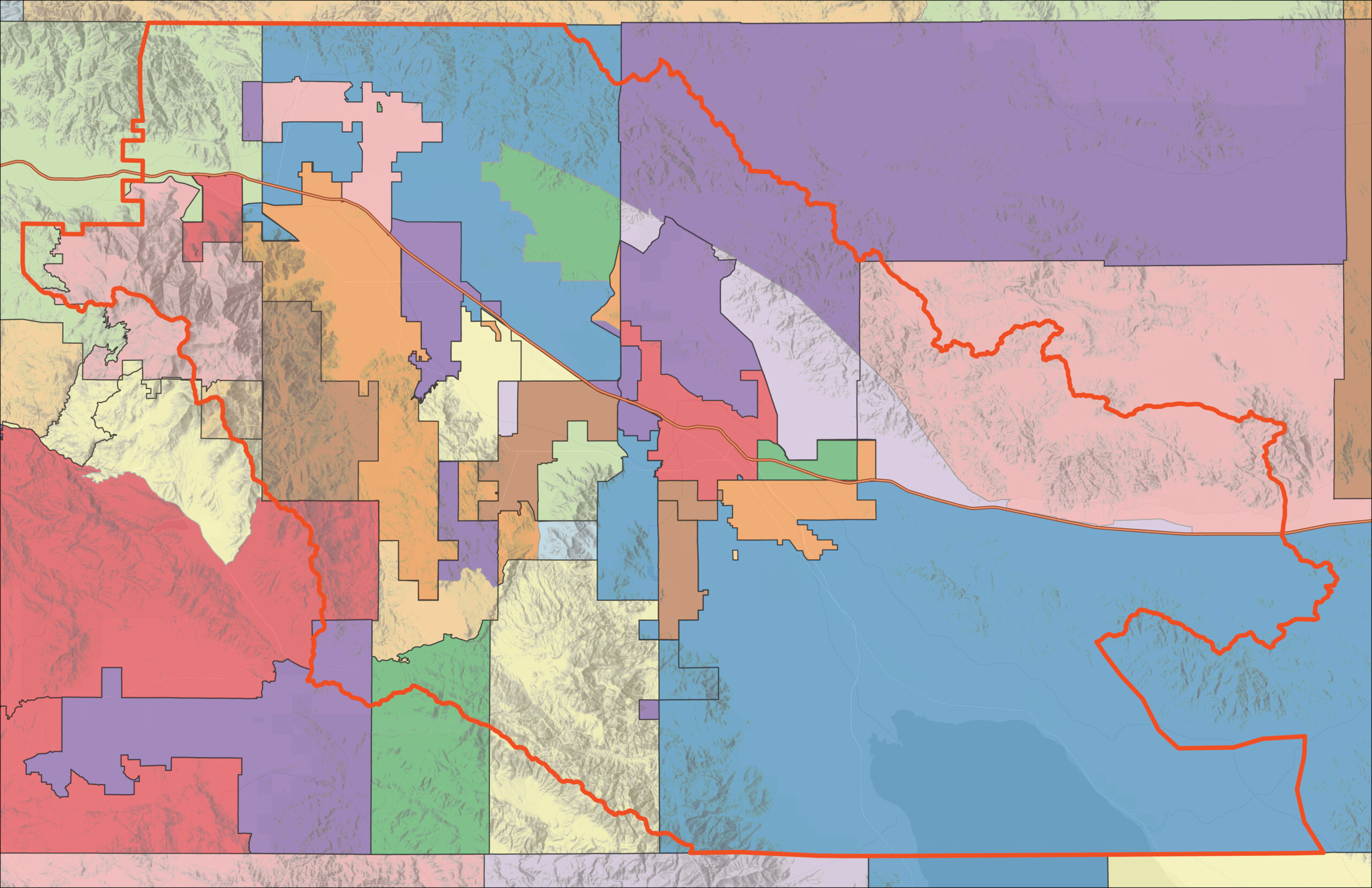
This map is an amalgam of five essential boundaries of our democratic system:
- U.S. Congressional Districts
- California Senate Districts
- California State Assembly Districts
- Coachella Valley Cities and Unincorporated areas
- School Districts
In this map, they have all been mushed together into individual overlapping puzzle pieces. In gis-speak, we call this a “union” of layers – a resultant jumble of variously sized polygons and boundary lines. This is the geographic puzzle of democracy.
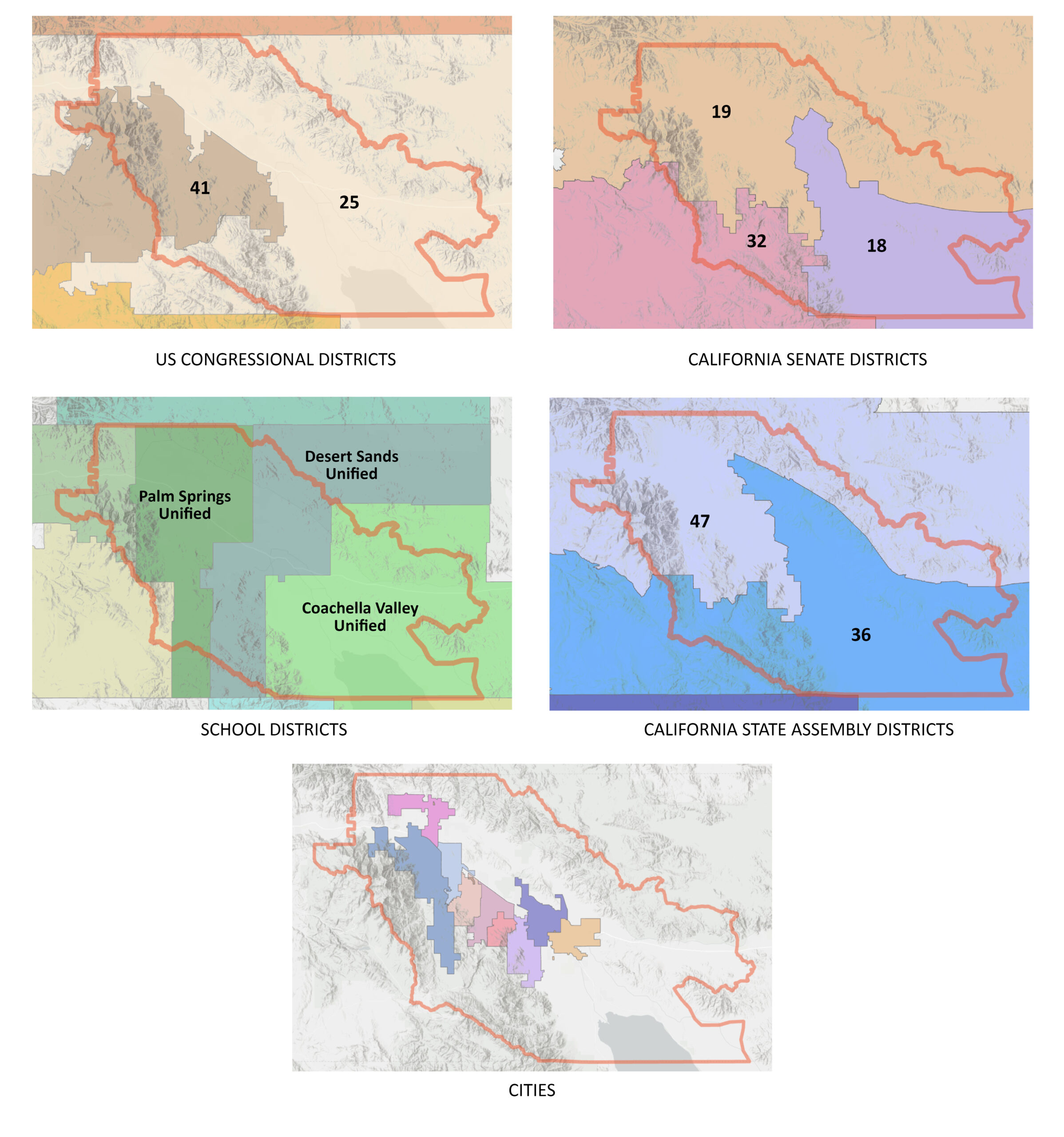
As complex as our first map is, we have simplified it by omitting many other local governmental bodies and special districts in order to maintain legibility and clarity. In a future Data Digest, we will illuminate the boundaries of local Native American Tribal Reservations and special districts, all of which add further richness and complexity to life and business in the Coachella Valley.


