

Happy New Year everyone! Not only do we have a new year, but we also now have new voting districts. On Monday, December 20, California’s redistricting commission approved the final redistricting map. Because of California’s slower population growth in the last ten years, we now have 52 Congressional Districts, one less than previous. But despite the state losing a district, the Coachella Valley actually split into two separate districts.
The following two maps chronicle the steps to these new congressional boundaries. After the 2000 Census redistricting, all the valley cities were included in district 45, except for Desert Hot Springs. Because of high population growth between 2000 and 2010, for 2010 redistricting, all valley cities were incorporated into one new district – District 36. More densely populated areas like Murrieta and Moreno Valley were put into different districts as the areas of the Coachella Valley, Banning, and eastern Riverside Counties now had a population high enough to warrant their own district.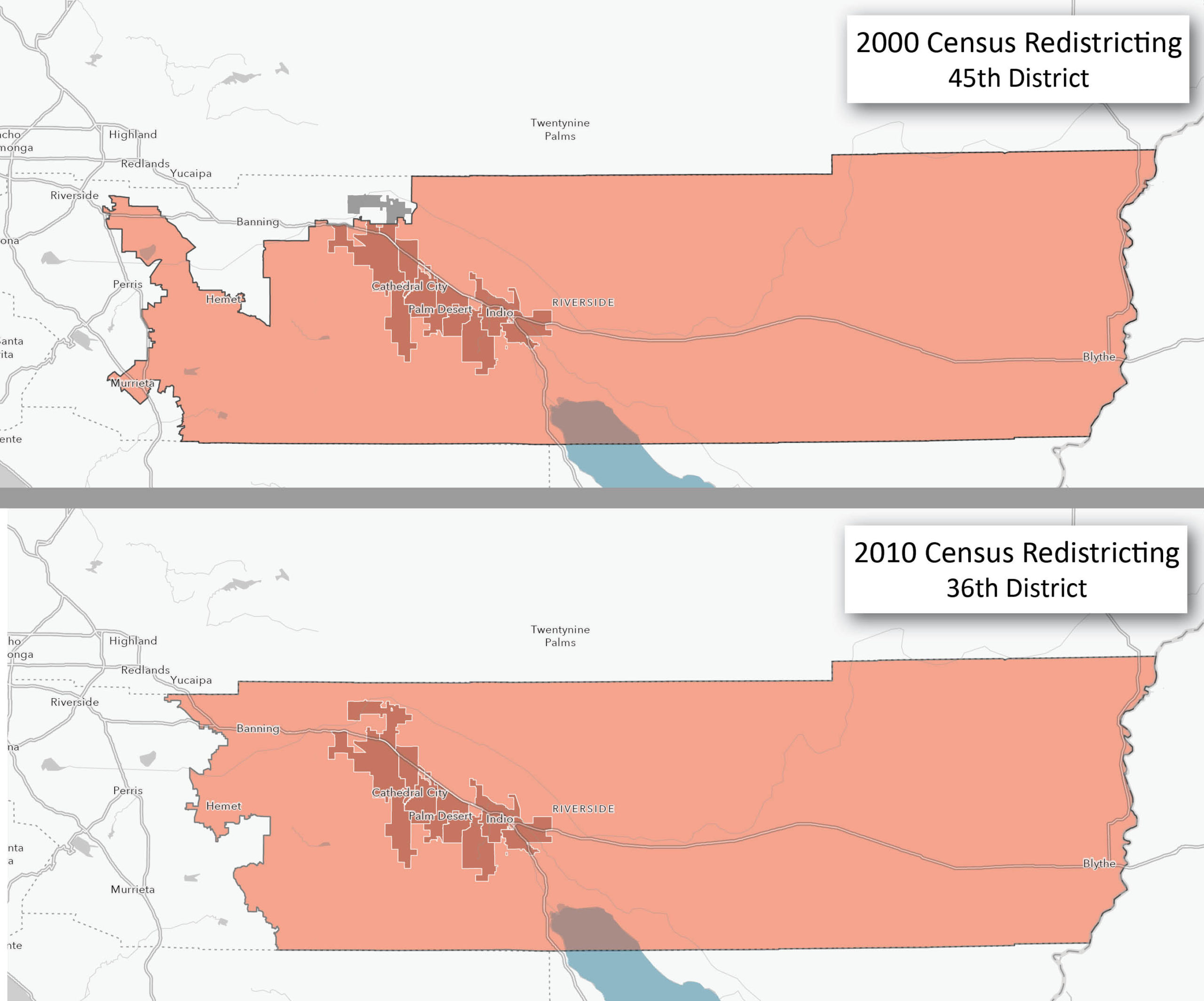
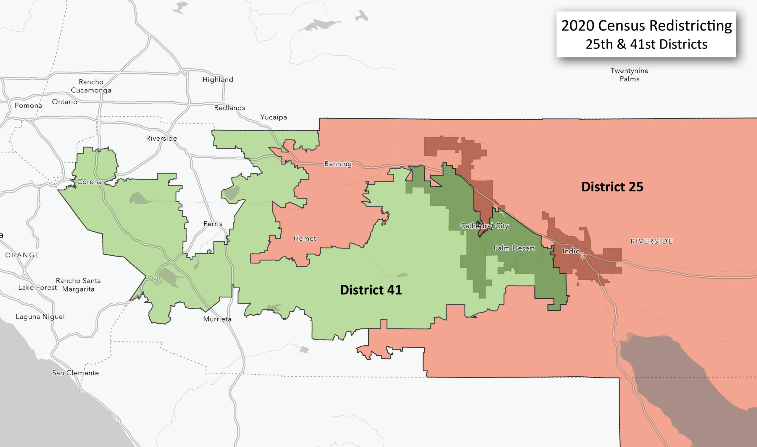
And here are our new decade’s congressional districts. Instead of the valley cities sitting in one contiguous district, they are now split into two – Districts 25 and 41. Desert Hot Springs, Cathedral City, Indio, and Coachella are now in new District 25. And new District 41 contains Palm Springs, Rancho Mirage, Palm Desert, Indian Wells, and La Quinta. This time population growth in our area outpaced the rest of the state prompting the need to split our area into two districts.
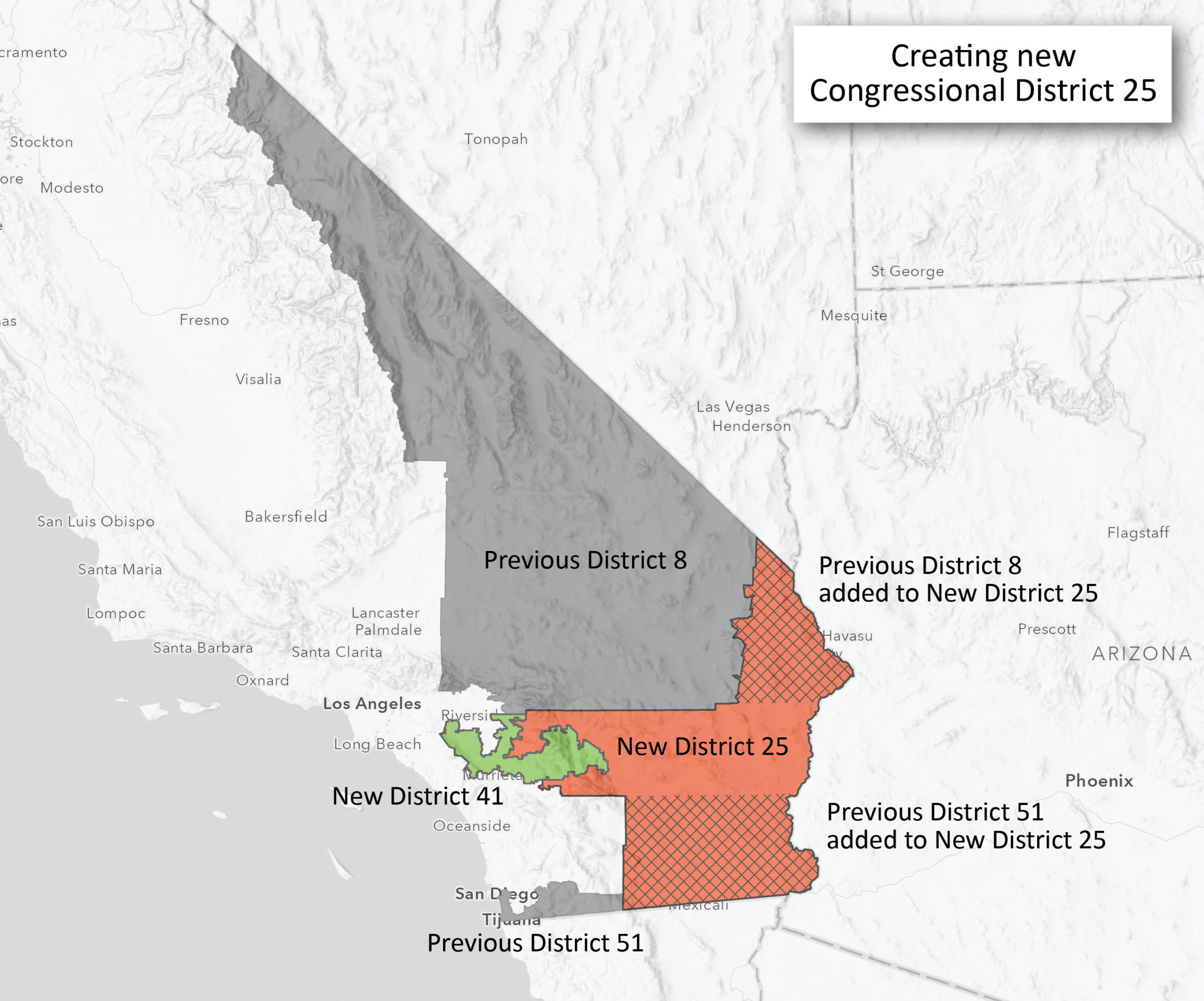
The final map shows the entire area of District 25. While our previous districts were contained in Riverside County, the new District 25 annexes parts of previous District 8 in San Bernardino County, and parts of previous District 51 in San Diego and Imperial Counties. In contrast, the new District 41 is decidedly smaller in area, incorporating five of our valley cities along with highly populated areas of Riverside County resulting in a distinctively “gerrymandered” undulating W-shaped district.


