

We continue our exploration of land designation in the Coachella Valley with an overview of zoning. Typically, counties or municipalities establish codes that divide the land into “zones” to guide growth and development within their jurisdiction. Zones define compatible uses for land and establish regulations for how to develop those uses, e.g., manufacturing.
Each city within the Coachella Valley has their own zoning regulations and produce zoning maps. For instance, here is a link to the City of Hot Springs zoning map. Apart from the nine incorporated cities in the valley, a substantial portion of the valley is unincorporated Riverside County and thus regulated by Riverside County zoning regulations.
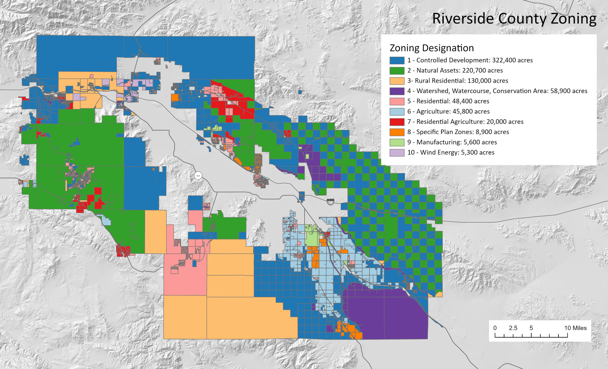
The map below shows the top ten Riverside County Planning zones, by total area (estimated), in the greater Coachella Valley area. The blank space in the middle represents the incorporated city areas. Take some time to explore the regulated land uses on the perimeter of the city areas. How might these perimeter zones affect adjacent city development, sustainability goals, etc.? Do they encourage or hinder economic growth?
Controlled development is the predominant zone here. Controlled development establishes a prescribed list of typically rural land uses like the non-commercial raising of horses or fowl, nurseries, greenhouses, etc. The second most common zone, Natural Assets, recognizes the importance of our unique natural landscape and thus greatly limits uses within this zone. Specific plan zones are specially designated areas regulated by the goals and interests of a jurisdiction’s General Plan. They are basically an overlay of additional rules and regulations not attainable through zoning rules alone.
Click here for a summary of Riverside County Zoning Requirements
Source: Riverside County


