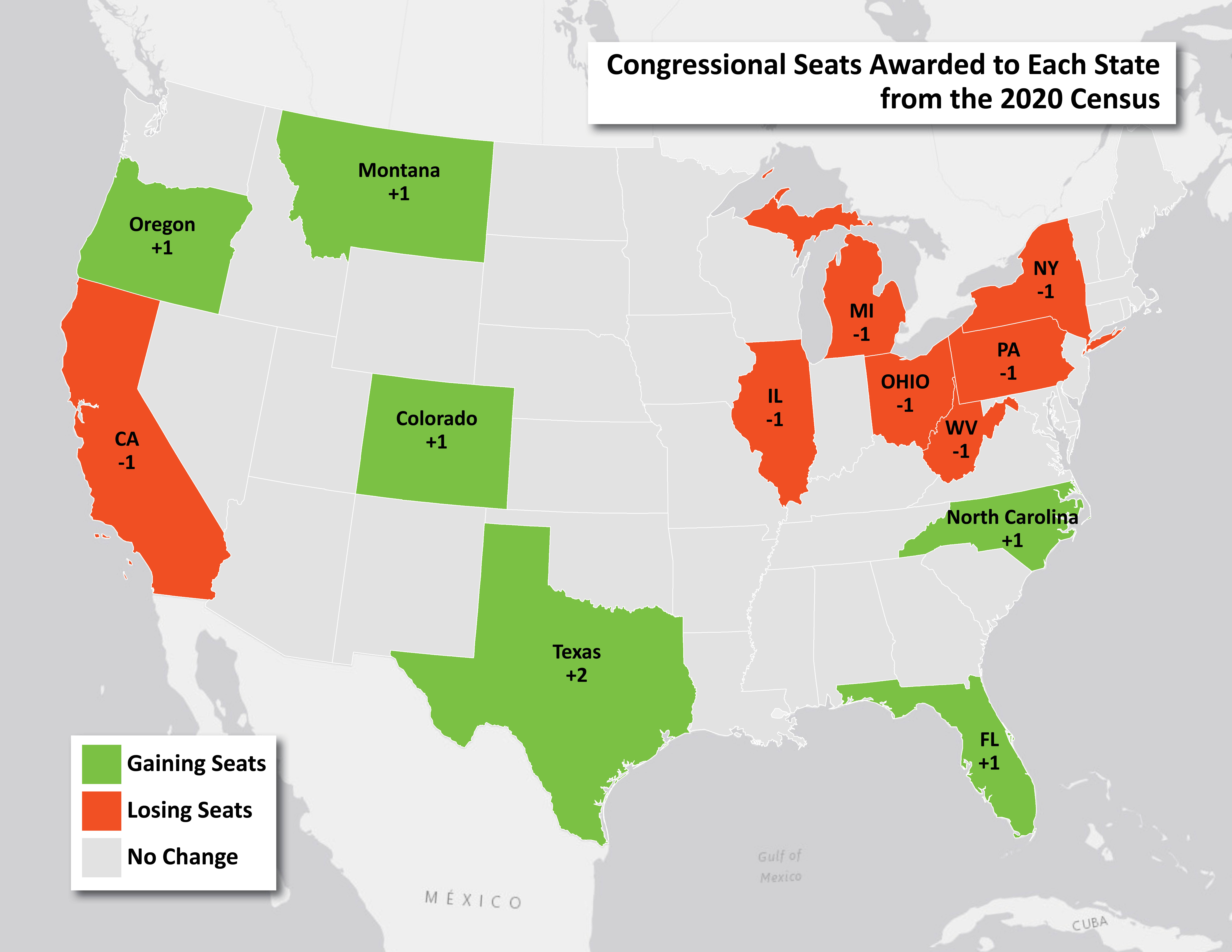
The numbers are in! And it doesn’t look good for California. The U.S. Census delivered state population data to President Biden that determine the apportionment of congressional seats. Congressional apportionment takes the new census population and divides it by 435, the number of seats in the House. Fast-growing states gain seats, while slow-growing or shrinking states lose seats. For the first time, California will be losing a seat. The shift of population continues to the south and west of the US, but no longer including California. Our state now joins the industrial belt in losing political power. More importantly, congressional district lines will be redrawn in the next months. Population in the Inland Empire grew in the last 10 years, so we will likely see a significant redrawing of our current districts.
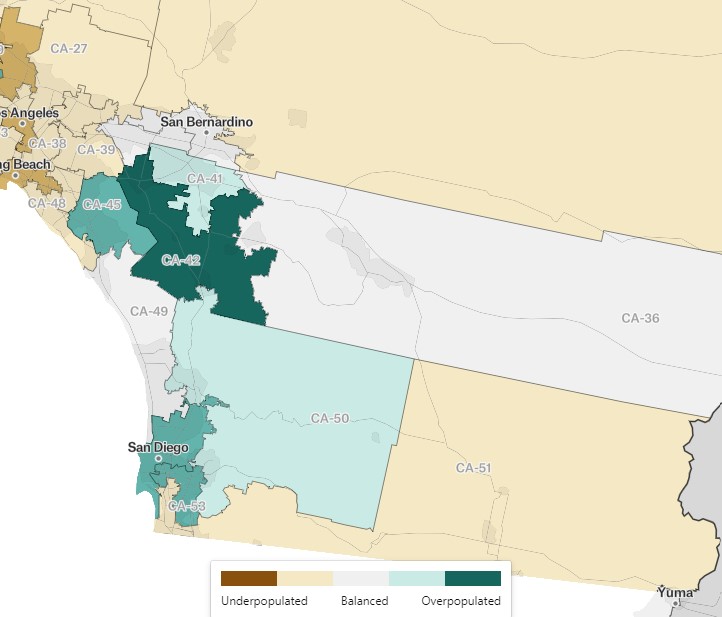
Congressional districts are meant to be proportional, meaning that each congressperson should represent an equal number of constituents. Azavea, a Spatial Analysis consultancy, publishes a map showing where congressional districts are over or underpopulated. This clip of their map shows that the Inland Empire, in which the Coachella Valley is located, is overpopulated, meaning that our congressional district should be smaller because of the greater rise in population (green areas) and subsequent density, as opposed to the beige/brown areas. It will be fascinating to see the reapportionment process proceed and see the resulting new boundaries of District 36.


